
Byway through Elkhart County
In 1913, Indiana native Carl Fisher laid out a plan to build America’s first paved transcontinental route. As the concept of a transcontinental road developed, some proposed to call it the Coast-to-Coast Rock Highway. Ultimately Fisher was urged to name the route the Lincoln Highway in honor of former President Abraham Lincoln, and to call on citizens’ patriotism to support the road-building efforts. Although it no longer officially bears Lincoln’s name as it once did, the highway remains a relevant and vital part of the communities along its path, attracting modern travelers desiring to travel off of the interstate highway system. The route is marked by beautiful commemorative signs through Elkhart County and generally follows US 33. Be aware that you will deviate a bit on and off the main road to follow historic road alignments where possible.
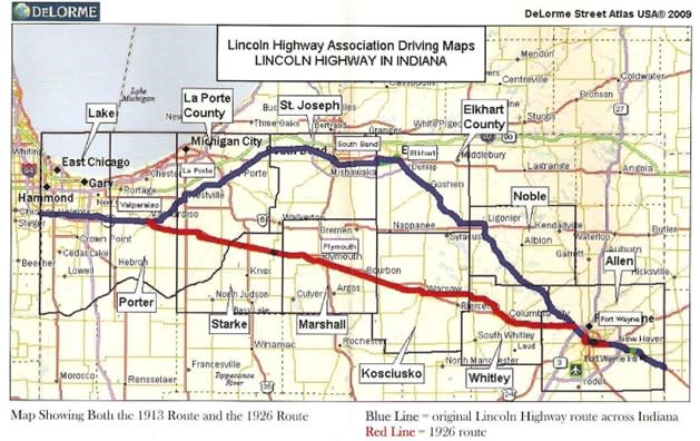
Indiana Lincoln Highway Byway Blue line = 1913 alignment; Red Line = 1928 alignment
Historically the original alignment of the Lincoln Highway across Indiana was a 170-mile route that connected Townley on the east to the town of Dyer on the west. In 1928, the Lincoln Highway route across Indiana was realigned to a more direct route south of the original route between Fort Wayne and Valparaiso and became the original US 30 across Indiana.
As you hit the road, remember that in its heyday from 1913 to 1960, the Lincoln Highway was America’s first transcontinental route for auto travel from New York City to San Francisco. Elkhart County citizens were excited to be part of this improved highway that brought travelers from near and far to the county.
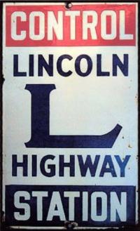
In order to provide assistance to tourists, local Control Stations were established in public buildings where information on the route and services could be found.
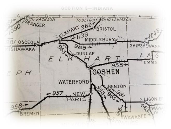
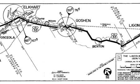
The historic map of Elkhart County shows the Lincoln Highway route through Benton, Goshen, and Elkhart. The highway entered from Ligonier in Noble County and exited toward Osceola in St. Joseph County. (Taken from the Automobile Green Book 1921, Scarborough Motor Guide Company, Indianapolis, Indiana.)
After the invention of the automobile, roads were steadily improved and the American landscape was transformed forever. Roadside services sprang up along highways offering campsites, cabins, gasoline, tourist attractions, and eateries. Highways connected towns along the route and brought travelers across the countryside to larger cities where they enjoyed the amenities of fine hotels, restaurants, and entertainment.
Local communities such as Goshen and Elkhart celebrated the growth of their communities with both industrial and Lincoln Highway parades. Roads and automobiles meant that people could explore America on their own and were no longer dependent on limited train routes and schedules. Auto travel became wildly popular following WWI in Europe, as people were not traveling abroad and the U.S. was developing the National Park system.
Courtesy University of Michigan/Lincoln Highway Collection
By 1924, or just 11 years after the formation of the nation’s first transcontinental road, the Lincoln Highway in Elkhart County was paved with brick and concrete. These improved surfaces provided an enjoyable and safe drive through northern Indiana’s rolling farmland in any season. The national Lincoln Highway Association sent crews across the country to paint the red, white, and blue Lincoln Highway logo on electric poles to assist travelers following the circuitous route.
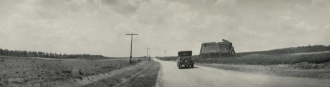
 Improvements to the Lincoln Highway were made rapidly in Indiana when compared to many states along the route. This image taken in 1922 captures an official vehicle of the Lincoln Highway Association inspecting the road in Elkhart County following improvements. Within a decade the Lincoln Highway in Indiana had been transformed from poor roads to state-of-the-art concrete and brick construction. The communities touched by the route were transformed as well. As the horseless carriage gave way to the automobile, services for travelers sprang up in small towns and cities all along the route. An adventure awaits as you travel on roads named Lincolnway East, Lincolnway West, Lincoln Highway, and others. Hoosiers are fortunate that nearly 90% of the original 1913 alignment of the Lincoln Highway can still be driven!
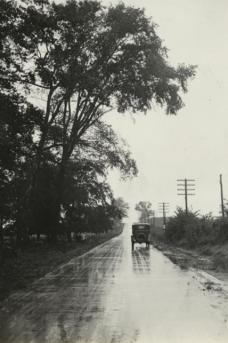
This rainy-day image taken by the Lincoln Highway Association in Elkhart County in the 1920s shows the official LHA auto on the Lincoln Highway in Elkhart County. Courtesy University of Michigan/Lincoln Highway Collection